Brief itinerary exploring the Mediterranean macchia and calanchi following the Rancioa riverbed [1] |
Podere Santa Pia | Hiking along the Rancioa riverbed in the hidden valleys below Castiglioncello Bandini |
This brief itinerary starts and ends at the gate of Podere Santa Pia in Castiglioncello Bandini. It explores the Mediterranean Macchia and calanchi, or badlands, in the valley below Podere Santa Pia, towards the stream Rancioa. Walking along a dry riverbed through the impressive declining grounds of the calanchi, hiking through hidden valleys while passing old ruins; it all offers a great experience. The roads and the paths going through this wild area give the visitor the opportunity to see sceneries of unexpected beauty.
|
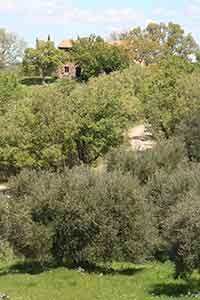
Starting Point, the cypresses of Podere Santa Pia In Tuscany, Cypress trees are a prevalent part of the landscape.
|
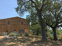
Podere Santa Pia, the garden, starting point.#poderesantapia
|
Directions following gpx tracks or on the map above
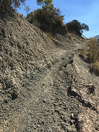
1 - Turn left and cross the olive grove to the south, towards another dirt road, here you turn right, steeply downhill 2 - Turn right, steeply downhill 3 - At the T-cross, turn left 4 - Podere Federano, an old farm in ruins, appears on your left. Walk around the stables and then leave the road and cross the field on your left, going down towards the river. In the corner, follow the river bank for a few minutes, until you reach a huge oak. There you can enter the river bed. 5 - Walk around the Downey Oak, where you can reach the riverbed. Follow the riverbed to your right, westwards
|
||||
 |
||||
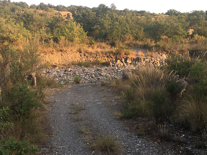
Where the river runs through the road
|
||||
7 - Turn right, uphill, climbing to Podere Federano. Walk around the farm and follow the dirt road towards Podere Santa Pia 8 - Continue following the trail to the left 9 - Turn right, steeply uphill 10 - Turn left, to cross the hill towards Podere Santa Pia, hidden between olive and oak trees. A beautiful view on this holiday resort and its grounds open up. 11- Here we hit the road again. Turn right for a final short stretch toward Podere Santa Pia.
|
|
|||
Podere Santa Pia | Brief itinerary exploring the Mediterranean macchia and calanchi in the valley between Podere Santa Pia and Cinigiano
|
||||
 |
 |
 |
||
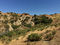
Castiglioncello Bandini, Calanchi in the valley beween Podere Santa Pia, Federano and the torrent Rancida |
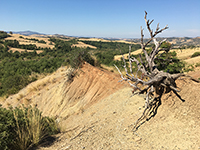
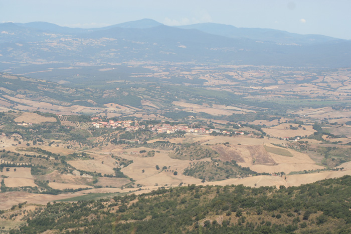
Cinigiano, view from Castiglioncello Bandini |
|||
|
Castiglioncello Bandini album
|
||||
 |
 |
 |
||
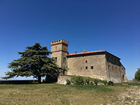
Castiglioncello Bandini, Castiglion del Torto
|
Celebrare il dolce far niente |
Cinigiano, view from Castiglioncello Bandini |
||
Taking a break in the shadow of an olive tree, just before reaching the ruins of Podere Federano.
|
||||
Along the rivers in Tuscany | Hiking along the Rancioa riverbed Traveling in Italy | Calanchi e biancane | Un tesoro della natura
|
||||